 |
 |
 |
 |
Rio Chiampeit

Description:
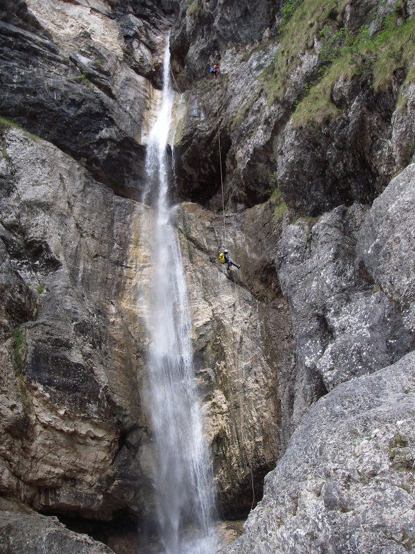
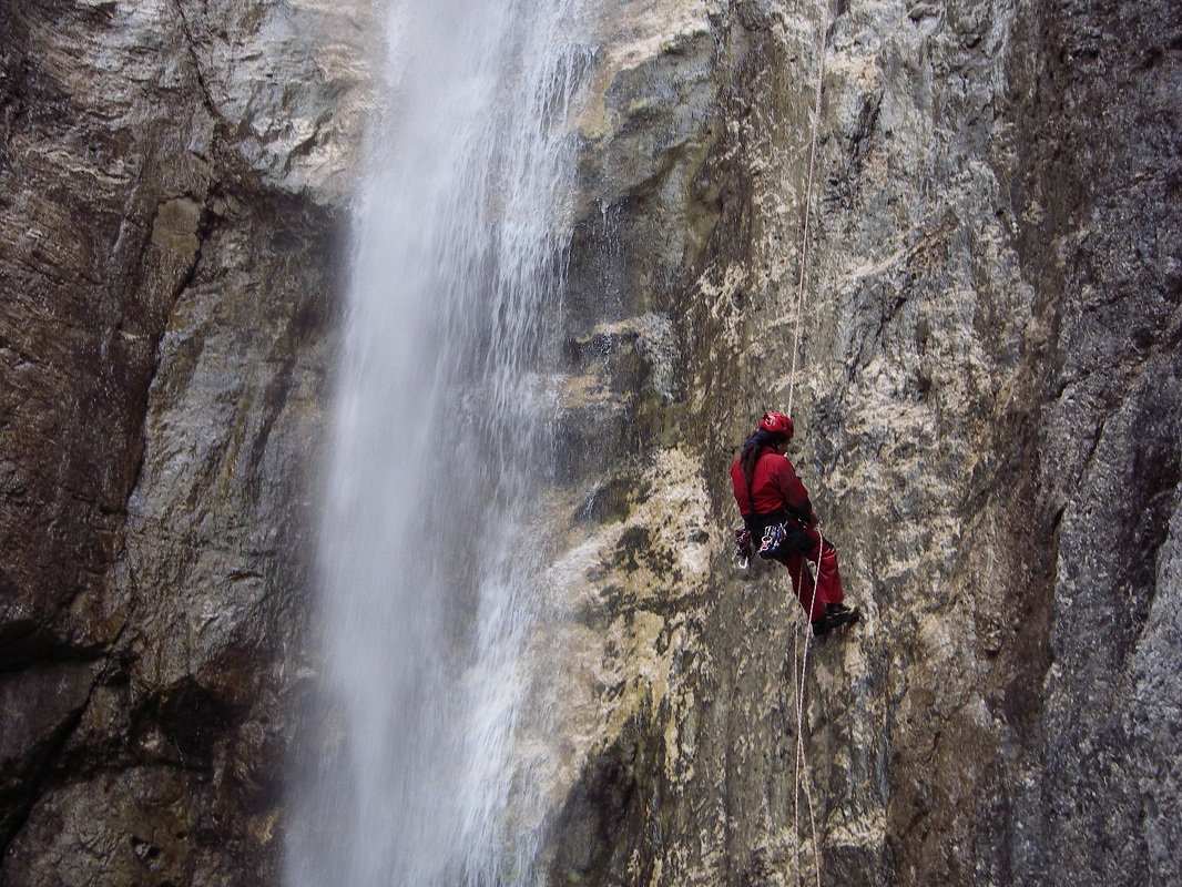
This is the canyon whose last pitch is clearly visible from the motorway Udine-Tarvisio, near the exit "Moggio Udinese" at the start of a tunnel.The most striking part of this canyon is this last waterfall, where a hanging pool overlooks this final pitch of 70 m. The first half of the canyon is usually dry, while the second half becomes wetter as water is received from a tributary on the left.

Zone:
Friuli Venezia Giulia - Moggio Udinese (UD)Elevation and lenght:
Entrance: 630 mExit: 300 m
Height difference: 330 m
Lenght: 1700 m
Highest pitch: 70/40 m
Advised decent period:
From May to OctoberExposure:
NorthTimings:
Approach: 1h 30 mins/45 minsDescent: 3h 30 mins
Return: 5 mins
Shuttle:
No / 2 kmAnchors:
SufficentAdvised ropes:
2 of 50 m / 2 of 80 + emergency rope Gear:
Complete wetsuit, bolting kit Escapes:
Just beyond the tributary, there is a track on the right bank that reaches the main path and that can be used as an escape route.Map:
Carta Tabacco 1:25000 foglio n° 018 - Alpi Carniche Orientali Canal del FerroInterest:
RegionalDifficoltŕ:
V5 a2 IVCoordinates (WGS84) for downstream (valley) parking:
46° 23' 48,7" N 13° 10' 47,9" ECoordinates (WGS84) for upstream (mountain) parking (stalli Ravorade):
46° 23' 37,5" N 13° 11' 10,8" ECoordinates (WGS84) of the riverbed access point (start of canyon):
-Approach to the valley (lower car park):
Drive along the SS 13 towards Tarvisio, near Moggio Udinese, pass under the motorway viaduct and continue for 450 m. Just before a right curve, take the road
on the right that leads to a large open space near the final waterfall (check the water level here). Alternatively, remaining on the SS 13, it is possible to
park where there is a curve to the right (mentioned above), but park on the opposite side of the road in a clear space in front of a commercial site.Approach to the mountain (upper car park):
With a second car with an adequately high suspension, it is possible to halve the journey by foot. From where the first car is parked, take the SS 13 in the
direction of Tarvisio. After about 750 m, turn right and take a road (paved only in the first section, then dirt track) that leads up to the Stalli Ravorade
(mountain hut at an altitude of 516 m), where you can park the car in the grassy area.Approach to the canyon (walking):
When you reach the Stalli Ravorade (on foot or by car), continue uphill until you find the path, on the right-hand side, to Stalli del Verzan, which is followed
to an altitude of 720 m. From here, go down easily to the streambed, where the canyon is wide and sunny.Description and technical notes
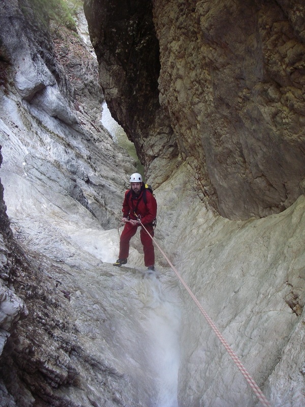
The first part is usually dry, so it is not necessary to wear the wetsuits until you meet the water.01 - P 11 L
02 - AN 20 R
03 - P 20 R
04 - TB 6 R
05 - P 28 R
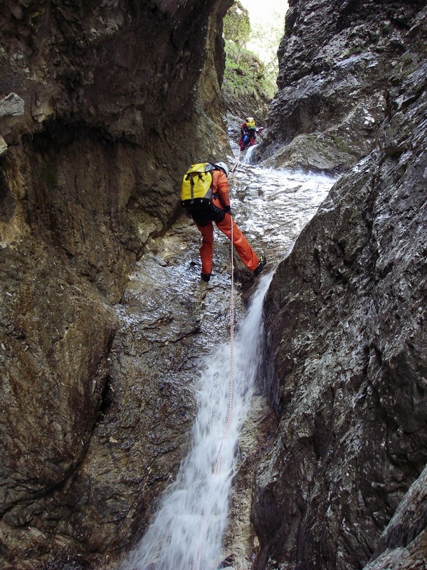
06 - MC + P 25 L
07 - P 5 R
Walking for approx. 200 m
Finally, the tributary enters from the left!
Walking for approx. 200 m
08 - J / D 4
09 - J 3 R
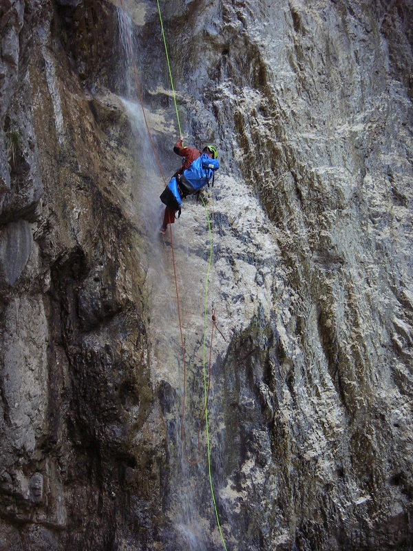
10 - P 7 L (requires a rope of 40 m) !! NOT jump as there are submerged boulders!!
Attention! This pitch leads directly to the hanging pool above the final 70 m pitch. Under normal hydrological conditions there should not be any problems, but you must not under-evaluate the flow in wet conditions.
first option:
The pitch can be dropped in a single decent of 70 m, but this requires a rope long enough for recovery.
11a - MC + P 70 Dx
second option:
The pitch can be split after approximately 20 m. Once you reach the ledge below the first part of the pitch, move left (orographic) to the terrace, where a few meters from the point of vertical descent there is a bolt.
11b - MC + P 20 R
12 - RB + P 45 L
Exit:
The canyon ends underneath the motorway viaduct and in 5 minutes you reach the car.Notes:
It is recommended to descend this route after a few days of rain to find a minimum flow in the upper part.
However, also consider that the first part of the final descent occurs directly under the flow of the waterfall.It is possible to descent only the final pitches by climbing up the main path to a curve to the left where there is a branching path / track in the direction of the river. Follow it, with an exposed section over a landslide (fixed ropes) until to reach the riverbed just downstream of the tributary that carries water (about 45 mins).
The first descent was in 1995.
URL:http://www.canyoneast.it
Layout, design & revisions © 2017, CanyonEast Canyoning Team - Seba Broili, Vanessa Johnston, Romy Siegl, Cristian Vogrig
Webmaster: uomonero@canyoneast.it - Revised - - 22/08/2017
Layout, design & revisions © 2017, CanyonEast Canyoning Team - Seba Broili, Vanessa Johnston, Romy Siegl, Cristian Vogrig
Webmaster: uomonero@canyoneast.it - Revised - - 22/08/2017


